Top 20 Flight Notebooks – Southwest U.S. Archives 2020 –

You will find interesting in-depth Private Flight aerial photographic journey’s / notes / reports / avionic upgrades covering the Southwest United States: Arizona, California, Utah, New Mexico and Nevada.
Considerable flying has been conducted in the U.S. National Parks and State Parks airspaces (uncovering some obscure points of interest to investigate!) We hope this helps you to plan and navigate a rewarding and safe flight or drive https://milehighgarage.biz/?p=1535 a cool auto route.

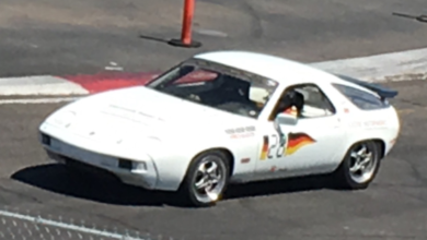
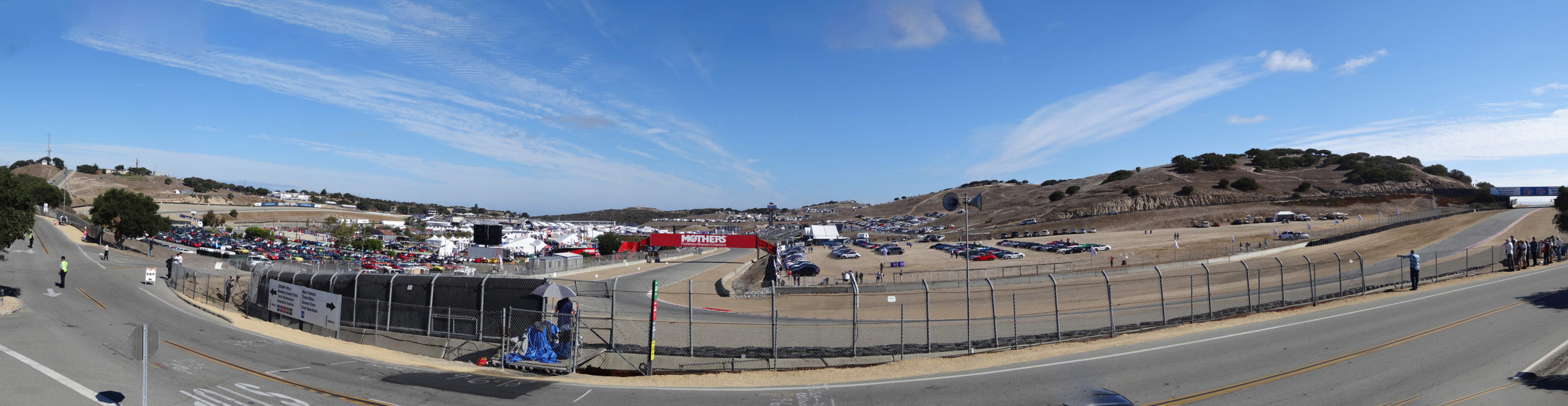
Aviation Sky Touring + Remote Motorsports Raceways
Find very detailed DOWNLOADABLE private aviation reports below.
We fly Private Aircraft to U.S. National Parks and Private Motor Speedways in the Southwest United States as both aviation and Porsche motorsports enthusiasts; and a way to rapidly advance flight expertise for commercial pilot ratings. These Private Aviation flight report archives cover considerable flight hours (dozens of trips) documenting / discussing my route planning, points of interest and supporting instrumentation notes.
There are tons of great aerial photos (FREE TO USE) and detailed avionics thoughts embedded in the report logs. I hope you find something in my logs enjoyable and useful when reading !
Private aircraft enthusiasts might find my report details useful for fine tuning your Flight route planning and/or checking out my instrumentation enhancements which might enlightening your trips across Arizona, Utah, New Mexico, Nevada or California. The scenery we have covered is fantastic historic and mind boggling; — like where can you find Hoodoos — ?!
If not into the instrumentation details — look at the cool aerial photos and historical sights discussion from the Air !
We have used extensive tagging and photo naming so it’s more possible to locate the area we are exploring.
REPORT ARCHIVE
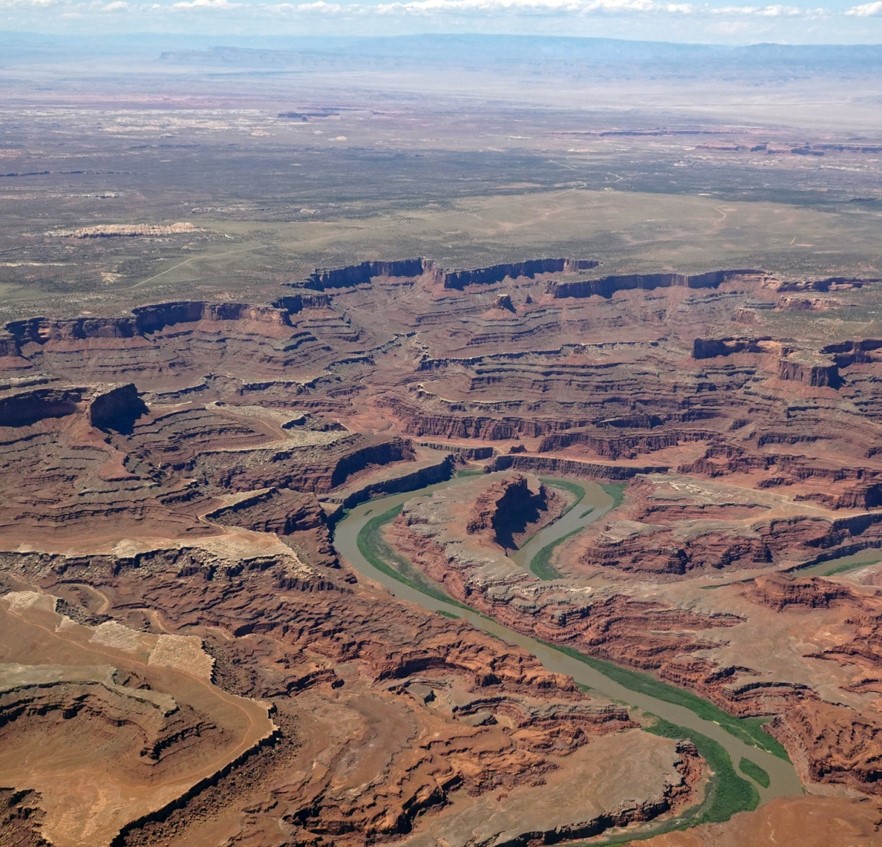
Grand Canyon + Lake Powell and broad vaccinity: The Grand Canyon and Lake Powell are some of the most beautiful areas in the southwestern United States. One of the Flights traveled north was through the center of the region (Tusayan) and the return skirted the eastern border through Page Arizona along the Colorado River. Great aerial photos of Vermilion Cliffs.
Enjoy the excellent aerial photos from above the Colorado River deep into the Canyon — taken of the torrential rapids — in some some places.
Lake Powell is a reservoir on the Colorado River, straddling the border between Utah and Arizona, United States.
2019_1105-GC-LP-Flight-photos-Part-2Download
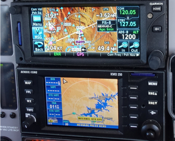
While Flying — our ground speed was 204 kt. (235 mph, 377 kph) Taking into account altitude and outside air temperature, the 193 kts True AirSpeed (TAS) displayed above translates our early numbers of to 222 mph – 357 kph. We maintained our 11,500 altitude until turning south, and descended to 10,500 ft.
The sleek design and high engine power separates the Mooney from most other general aviation aircraft. This M20R sports a 310 hp 540 cu.in. (8.8-liter) 6-cylinder engine with a three blade prop
The fuel consumption was about 23 gallons and the fuel flow rate is 12.5 gallons per hour.
Utah + Arizona U.S. National Parks and State Parks … plus: Grand Canyon – Grand Staircase – Zion – Arches – Moab – Canyonlands – Capitol Reef – Bryce Canyon – Dead Horse- Escalante – Fish Lake – Vermillion Cliffs – Lake Powell – Colorado River – Green River – Goblin State Park (hoodoos) – Holbrook, Arizona – Joseph City – The Navajo National Monument Area – Glen Canyon Dam – Marble Canyon – Monument Valley – Rainbow Bridge
Canyonlands / Moab is divided into four districts: The Island in the Sky, The Needles, the Maze, and The Combined Rivers—the Green and Colorado—which carved two large canyons into the Colorado Plateau. While these areas share a primitive desert atmosphere, each retains its own character.
The U.S. National and State Parks preserves a colorful landscape eroded into numerous canyons, mesas, and buttes — featuring the Colorado River, the Green River, and their respective tributaries.
Dead Horse Point State Park is a Top 10 Utah scenic tour featuring a dramatic overlook of the Colorado River and Canyonlands National Park.
According to legend, the park is so named because
of its use as a natural corral by cowboys in the
19th century … sadly where horses often died of exposure.
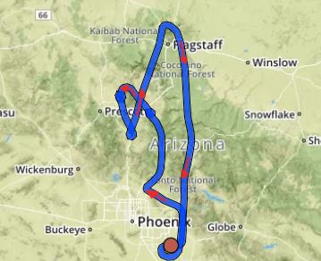
Norther Arizona: Flagstaff – Sedona – Jerome – Mingus Mountain – Camp Verde – Oak Creek Canyon – Verde Valley – Cordes Junction (Arcosanti) – Prescott – San Francisco Peaks – Snow Bowl Ski Area – Meteor Crater (separate report)
Notes: 2000 ft/min (210 m/min) rate of climb is great in general aviation
Manage Your Attitude ! – Banks + Ground Reference
Canyon Lake – Mormon Flat Dam – Saguaro Lake – Salt River – Stewart Mountain Dam – Roosevelt Lake – Apache Lake – Apache Trail, Bartlett Lake – Four Peaks – Horseshoe Lake + Dam – Mt Ord – Superstition Mountain Wilderness – Tortilla Flat – Payson – Mazatzal Wilderness – Verde River ( Arizona’s only Wild River designation ) – Mogollon Rim – Tonto Basin – Fountain Hills
Painted Desert, Petrified Forest, Holbrook, Winslow, Meteor Crater, Show Low, Arizona to St. Johns and then into New Mexico in the direction of Albuquerque, NM.
North Eastern Arizona: Four Corners Monument – Cortez Colorado – Gallup, New Mexico – Little Colorado River – Winslow Arizona – Shiprock – Ancient Pueblo People – Anasazi – Canyon de Chelly National Monument – Navajo Nation and encompassing 3 major Canyons cut by streams with the Headwaters in the Chuska Mountains; just to the east of the Monument.
a) Canyon de Chelly
b) Canyon del Muerto
c) Monument Canyon
Canyon de Chelly is one of the most visited national monuments in the United States.
This Flight journey and aerial photograph scenery encompasses the vast area North of San Francisco Peaks in Flagstaff, Arizona and just South of the Grand Canyon; including a wide swing East into the edges of the Painted Desert, Monument Valley and the Little Colorado tributaries off of the Little Colorado River.
Kayenta – Hopi Reservation- Navajo Nation – Monument Valley – Clear Creek – Winslow Arizona – Little Colorado River Tributaries
Southern and South Eastern Arizona — into New Mexico.
Including aerial views of many Border Towns across the Mexico – United States demarcation. Bisbee – Douglas – Naco – etc